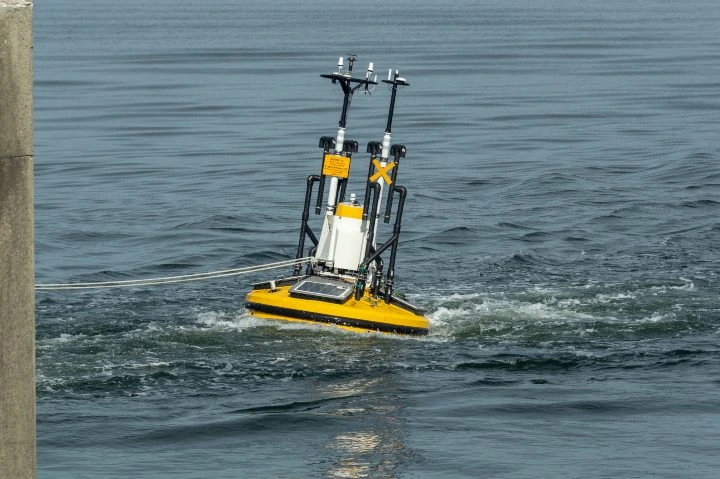
LiDAR is a remote sensing technology that uses high-powered lasers and light energy to measure distances. It works by emitting laser pulses toward an object, measuring the time it takes for the reflected signal to return, and using this data to calculate precise distances. This process allows LiDAR systems to generate detailed 3D models of environments, making it a powerful tool in various fields. The data collected can be used for mapping, navigation, and even safety assessments in hazardous areas. LiDAR has a wide range of applications, from aerial surveys to underwater mapping. Its versatility makes it valuable across industries such as agriculture, construction, and environmental monitoring. The integration of LiDAR with drones has made it especially useful in situations where human access is limited or dangerous. This has expanded its use in inspections, disaster response, and more. LiDAR stands for Light Detection and Ranging. It is a remote sensing method that uses laser light to measure distances and create accurate 3D representations of objects and environments. By emitting laser pulses and analyzing the reflected signals, LiDAR can collect detailed spatial data, which is then used to build digital models. This technology is widely used in mapping, autonomous vehicles, and environmental studies. An Ouster OSO-32 LiDAR sensor LiDAR was first developed in the 1960s, when scientists began experimenting with laser technology. At the time, it was not yet called LiDAR, but rather a combination of "light" and "radar." Early versions were used for mapping small rivers and streams. In the 1980s, with the advent of GPS, LiDAR became a key tool for large-scale geospatial data collection. However, early systems were bulky, expensive, and difficult to operate. Today, LiDAR has evolved into a compact, affordable, and highly accurate technology. Modern devices like smartphones now include LiDAR sensors, capable of creating 3D models from a distance of up to 15 feet. This has opened up new possibilities for consumer and industrial use alike. LiDAR sensors along with visual sensors on a smartphone As LiDAR technology continues to advance, its applications are expanding rapidly. From autonomous vehicles to environmental monitoring, LiDAR is playing a crucial role in shaping the future of many industries. Regardless of whether it's mounted on a drone, plane, or handheld device, LiDAR works by emitting laser pulses and measuring the time it takes for them to reflect back. This information is then used to calculate distances and create 3D maps. Similar to radar and sonar, LiDAR uses light instead of sound or radio waves. By combining the direction of the laser, the position of the scanner, and the distance measured, LiDAR can accurately map the 3D structure of any environment. Every LiDAR system consists of three main components: The laser emits pulses of light toward the target. These pulses vary in color and intensity depending on the type of data being collected. When they hit an object, they reflect back to the system. The scanner, also known as the receiver, captures the reflected laser pulses. Depending on the application, different types of lenses and optics may be used to collect and process the returning signals. To ensure accuracy, the LiDAR system must know its exact location. Most modern systems are equipped with GPS to determine their position and orientation in real-time. Additional hardware, such as batteries, imaging systems, and data collectors, may also be included depending on the specific use case. The basic principle of LiDAR can be expressed mathematically as: d = c * t / 2 Where: LiDAR offers numerous advantages over other 3D modeling technologies, such as photogrammetry. One of its biggest strengths is its precision, allowing it to capture details as small as individual molecules. Unlike photogrammetry, which relies on thousands of images, LiDAR collects data quickly and efficiently. It also performs well in low-light conditions, making it ideal for use in mines, forests, and other dark environments. This reliability makes LiDAR particularly valuable in safety-critical applications, such as emergency response and infrastructure inspection. It enables accurate measurements regardless of environmental conditions, which can be life-saving in certain scenarios. Other benefits include: LiDAR systems can be categorized based on several factors, including the type of laser used, the orientation of the sensor, and the platform it is mounted on. One key distinction between LiDAR systems is the type of laser they use. Common types include: LiDAR systems can also be classified by how they are oriented relative to the object being scanned: Finally, LiDAR can be categorized by the platform it is mounted on, such as drones, airplanes, or satellites. Each platform offers unique advantages in terms of coverage, resolution, and accessibility. With its growing capabilities, LiDAR is now used in a wide range of industries. Here are 12 of the most common applications: A LiDAR sensor mounted on an aquatic platform LiDAR is used to quickly capture detailed data at accident sites, helping emergency responders assess the situation and aiding in legal investigations. It helps farmers monitor crop health, track livestock, and detect pests, improving efficiency and productivity. LiDAR is used in meteorology to study clouds, pollution, and atmospheric gases, providing critical data for weather prediction and climate research. LiDAR has been instrumental in uncovering ancient structures hidden beneath dense vegetation, revealing historical sites that would otherwise remain undiscovered. Environmental agencies use LiDAR to monitor forests, water bodies, and wildlife habitats, supporting conservation efforts and resource management. Drones equipped with LiDAR can inspect hard-to-reach areas, such as power lines, bridges, and pipelines, reducing risks for workers. Insurance companies use LiDAR to assess damage quickly and accurately, speeding up claims processing and reducing costs. LiDAR helps foresters measure tree heights, canopy density, and ground features, enabling better forest management and planning. Police departments use LiDAR for speed detection and surveillance, while military forces use it for reconnaissance and battlefield analysis. LiDAR is used to map mine sites, assess safety after explosions, and monitor geological formations, improving operational efficiency and safety. Transportation planners use LiDAR to design roads, manage traffic, and improve infrastructure, ensuring safer and more efficient travel. Autonomous vehicles rely on LiDAR to detect obstacles, navigate safely, and maintain accurate positioning, making it a vital component of driverless technology. Wear Resistant Plate,Hot Rolled Wear Resistant Plate,Abrasion And Wear Resistant Plate,Wear Resistant Steel Plate Shandong Great Steel Co.,Ltd , https://www.great-steel.comWhat Is LiDAR?
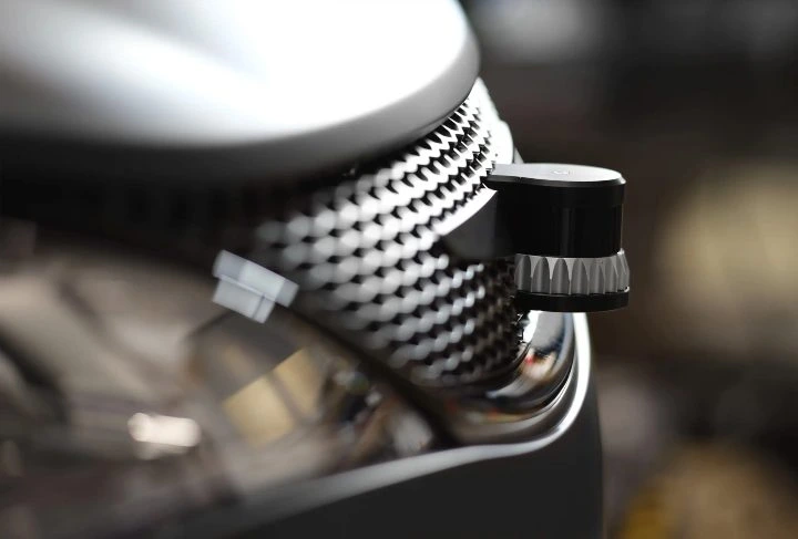
 Flyability's Elios 3's LiDAR sensor glows green as it flies through a water treatment plant
What Is LiDAR?Â

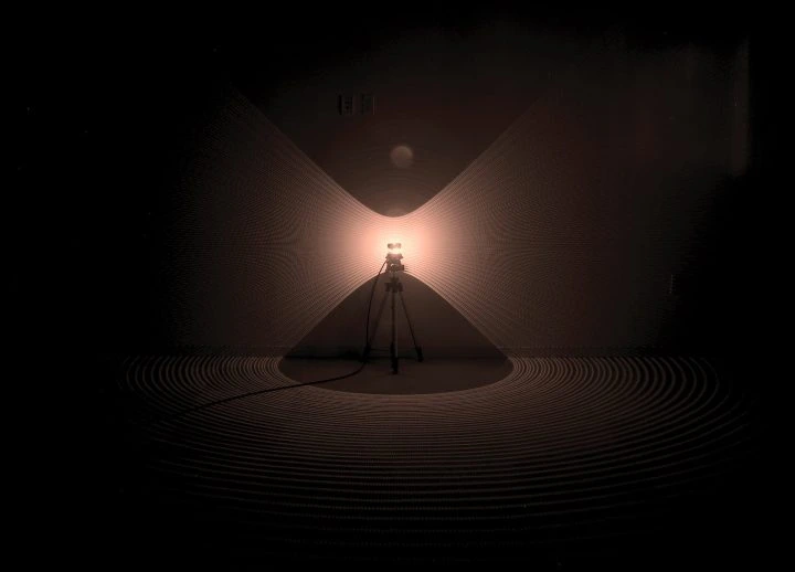
How Does LiDAR Work?Â
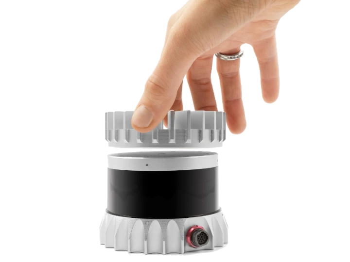
 An infrared photo of a LiDAR sensor |Â Credit: Ouster
1. The Laser
2. The Scanner
3. Global Positioning System (GPS)
LiDAR Formula
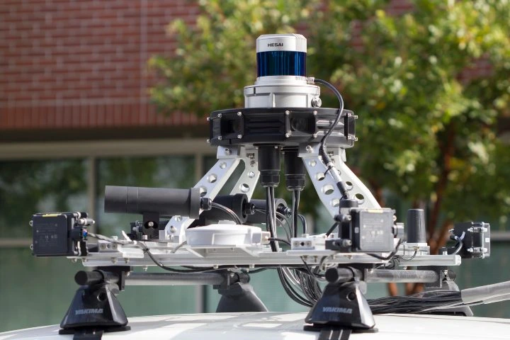
 An Ouster LiDAR sensor attached to a car
Benefits of LiDAR
 A LiDAR sensor mounted to a self-driving car
Types of LiDAR
Laser Type
Orientation
Platform
LiDAR Uses and Applications
1. Accident Scenes
2. Agriculture
3. Atmosphere
4. Archeology
5. Conservation
6. Inspections
7. Insurance
8. Forestry
9. Law Enforcement
10. Mining
11. Transportation
12. Self-Driving Cars